The renewal of a research vessel fleet
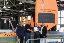
When contemplating the replacement of a research and survey fleet, a collective effort is required to meticulously curate an optimal new fleet, considering factors such as ship type, size, capabilities...

When contemplating the replacement of a research and survey fleet, a collective effort is required to meticulously curate an optimal new fleet, considering factors such as ship type, size, capabilities...
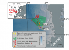
World oceans host diverse creatures that shape the seafloor. In a groundbreaking interdisciplinary study published in Communications Earth & Environment, Kiel University geoscientists, alongside biology and oceanography experts, have linked...
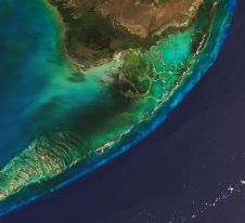
The Florida Department of Environmental Protection has commissioned Woolpert to acquire bathymetric survey data using Lidar technologies to support the Florida Seafloor Mapping Initiative (FSMI) and its mission to produce...
Combining the DriX uncrewed surface vehicle (USV) and the FlipiX remotely operated towed vehicle (ROTV), Exail has developed a unique solution enabling fully autonomous and remotely operated surveys. Combining the DriX uncrewed surface vehicle (USV) and the FlipiX remotely operated towed vehicle (ROTV), Exail has developed a unique solution enabling fully autonomous and remotely operated surveys. Accurate surveys...

Rijkswaterstaat, part of the Dutch Ministry of Infrastructure and Water Management, is responsible for managing and maintaining the main infrastructure facilities in the Netherlands. As part of its efforts to...

Various attempts have recently been made to expand the scope of research in the maritime field through the convergence of cutting-edge technologies. One example is the remote classification and prediction...
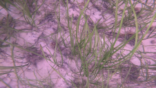
Seagrass meadows play an invaluable role as critical ecosystems that contribute significantly to marine biodiversity, carbon sequestration and coastal protection. In recent years, the importance of these underwater habitats has...
Saildrone recently announced that it has received the world’s first marine classification for a commercial uncrewed surface vehicle (USV) – the Saildrone Voyager – from the American Bureau of Shipping...
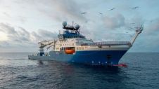
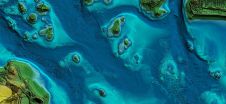
Seafloor mapping during a Schmidt Ocean Institute expedition has unveiled an underwater mountain twice as high as the Burj Khalifa, the world’s tallest building, in international waters off Guatemala. The...
In this article, we examine the evolving landscape of bathymetry with insights from Anders Ekelund, vice president of airborne bathymetric Lidar at Hexagon Geosystems. Beyond mapping seagrass, Ekelund unveils Lidar’s...
This site uses cookies. By continuing to use this website, you agree to our Cookies Policy. Agree