Mobile 2.0 for iPhone
Navionics will be hitting the water with the newest version of our Mobile App created specifically for iPhone users. The charts are available for an expert mariner already familiar with...
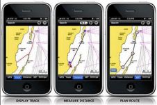
Navionics will be hitting the water with the newest version of our Mobile App created specifically for iPhone users. The charts are available for an expert mariner already familiar with...
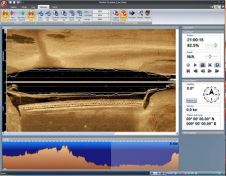
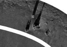
Tritech International Ltd announce the launch of the new StarFish, Scanline V2.0 Software. StarFish is a side-scan sonar which produces images of the seabed and has improved capabilities. Tritech are...
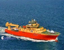
General Robotics is shipping DeepLive 2.0, its real-time data input module. The first customer is DeepOcean AS for its new Inspection, Maintenance & Repair (IMR) vessel, the Edda Fauna which...
Combining the DriX uncrewed surface vehicle (USV) and the FlipiX remotely operated towed vehicle (ROTV), Exail has developed a unique solution enabling fully autonomous and remotely operated surveys. Combining the DriX uncrewed surface vehicle (USV) and the FlipiX remotely operated towed vehicle (ROTV), Exail has developed a unique solution enabling fully autonomous and remotely operated surveys. Accurate surveys...
Twenty years ago, Norcom Technology first began to develop their bespoke software for the hydrographic industry. The company started by Phil Harris in 1986 employed just one other computer programmer,...
Hydro International’s annual Business Guide is now available! We take pride in presenting a comprehensive reference work featuring the results and analysis of our industry survey, a tradition we are honoured to uphold. This year’s report, incorporating valuable input from survey participants, is more extensive and in-depth than ever. Hydro International’s annual Business Guide is now available! We take pride in presenting a comprehensive reference work featuring the results and analysis of our industry survey, a tradition we are...
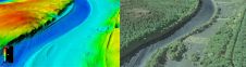
The US Geological Survey (USGS) and Dewberry have jointly released a new topobathymetric Lidar dataset for the Potomac River, extending from the Potomac Highlands in West Virginia to the Chesapeake...
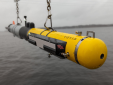
L3Harris, Voyis and Wavefront have joined forces to introduce cutting-edge technology aimed at enhancing the autonomous underwater vehicle (AUV) capabilities of the NATO Navy. L3Harris specializes in the development of...
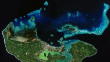
Coastal zones, situated at the intersection of land and ocean, hold immense social, economic and ecological significance. Currently, nearly 40% of the global population resides within 100km of the coast,...

Ocean data has a vital but underappreciated role to play as an enabler in shipping’s energy transition. In particular, it can help to unlock the short-term carbon savings that will...
This site uses cookies. By continuing to use this website, you agree to our Cookies Policy. Agree