Project SHOA, Waves in Chile
A detailed study of swell wave conditions in the southern Pacific Ocean has been performed, with particular emphasis on the western Southern American coastline. This study was one part of...
A detailed study of swell wave conditions in the southern Pacific Ocean has been performed, with particular emphasis on the western Southern American coastline. This study was one part of...
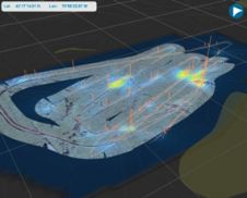
Port Hercule in the Principality of Monaco has been extended, in 2002, with a floating breakwater and a counter-jetty which have considerably augmented the reception capabilities of it. The vocation...

In November 1941 the aircraft carrier H.M.S. Ark Royal was returning from Malta, when it was torpedoed and sunk by a German U-boat southeast of Gibraltar. Its destruction was a...
The Flemish Hydrography is responsible for surveying the river Scheldt on Flemish territory up to the lock of Wintam. On the Dutch Western Scheldt Flemish Hydrography surveys only to check...
Privatisation as an answer to the financial challenges of survival has become a trend among public organisations, and hydrography is no exception. Private enterprise, worried about ‘unfair competition’, often looks...
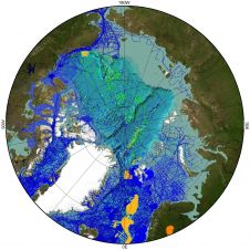
Drifting echo-sounding buoys will soon provide bathymetric control in inaccessible areas of the oceans. The SSPARR (Seafloor Soundings in Polar and Remote Regions) buoy project holds great promise for providing...
The Rivers Plate and Paraná in Argentina have much natural sedimentation. In 1993 the Argentine government issued a tender for dredging and signalization of these vital waterways. The concession runs...
The U.S.S Niagara, a steam-run and sail-powered frigate launched in 1856 and commissioned in 1857, was a part of the Civil War northern blockading fleet and escort, which also played...
Fugro's latest generation of Remotely Operated Towed Vehicle (ROTV) enables it to continue to provide its clients with high definition and more efficient acoustic subsea pipeline inspection service in the...
Hydramotion Ltd has launched its new MudBug MB400 system for determining the nautical depth of navigation channels by measuring the in-situ density of liquid silt or 'fluid mud'. A rugged,...
This site uses cookies. By continuing to use this website, you agree to our Cookies Policy. Agree