Found 2671 results
Sort by

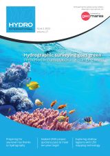
Hydro International #2- 2023

Which methods are being used to collect bathymetric data? How is that data converted into accurate bathymetric maps? And what else can it be used for? This issue zooms in on the latest developments in terms of both the hardware for capturing and generating accurate hydrographic data, and the software for processing it. This edition also takes a closer look at the wide variety of uses for hydrospatial data, including sometimes less-obvious applications. Which methods are being used to collect bathymetric data? How is that data converted into accurate bathymetric maps? And what else can it be used for? This issue zooms in...

Read more

GEOMOD

GEOMOD is a software development company specialized in marine geomatics and hydrography. Since 2004, we have been building our expertise on hydrographic products dedicated to mariners, harbour workers, and hydrographic...

Read more

An automated and reliable solution for the generalization of nautical charts

Cartographers working in hydrographic offices and ENC editors have the responsibility of processing bathymetry datasets to generate ENCs compliant with the S-57 IHO standard​. This is a time-consuming and fastidious task that requires a specific set of skills and knowledge. Nowadays, this expertise is challenged by the constant progress being made in data acquisition techniques and equipment, which has led to a significant increase in the number and size of bathymetry datasets. To face these challenges, the CARTONAUT project was launched by Shom cartographers in collaboration with GEOMOD marine geomatics engineers, both located in Brest, France. The project led to the creation of CALHYPSO, an automated solution for the generalization of bathymetry datasets for S-57 ENC production. This article reports the development of CALHYPSO through the CARTONAUT project and provides details about the tool’s concept and features. Cartographers working in hydrographic offices and ENC editors have the responsibility of processing bathymetry datasets to generate ENCs compliant with the S-57 IHO standard​. This is a time-consuming and fastidious...

Read more

River monitoring network in northern Germany – a case study

In July 2022, an environmental disaster hit the Oder River, a vital waterway for both Poland and Germany. The mass die-off of fish triggered an extensive investigation into the possible causes, but could this tragedy have been prevented? In July 2022, an environmental disaster hit the Oder River, a vital waterway for both Poland and Germany. The mass die-off of fish triggered an extensive investigation into the possible...

Read more