EMODnet Geology updates seabed maps for EU and Caribbean
EMODnet Geology is extending its offer with new and updated data products on seabed substrate maps for EU waters and the Caribbean Sea and seabed erosion. The European Marine Observation...

EMODnet Geology is extending its offer with new and updated data products on seabed substrate maps for EU waters and the Caribbean Sea and seabed erosion. The European Marine Observation...

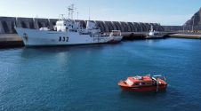
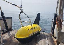
This year saw the first Exail Maritime Users Conference. Exail, you say, who are they? Exail is a new company that was formed by the merger between ECA and iXblue....
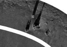
Combining the DriX uncrewed surface vehicle (USV) and the FlipiX remotely operated towed vehicle (ROTV), Exail has developed a unique solution enabling fully autonomous and remotely operated surveys. Combining the DriX uncrewed surface vehicle (USV) and the FlipiX remotely operated towed vehicle (ROTV), Exail has developed a unique solution enabling fully autonomous and remotely operated surveys. Accurate surveys...
Hydro International’s annual Business Guide is now available! We take pride in presenting a comprehensive reference work featuring the results and analysis of our industry survey, a tradition we are honoured to uphold. This year’s report, incorporating valuable input from survey participants, is more extensive and in-depth than ever. Hydro International’s annual Business Guide is now available! We take pride in presenting a comprehensive reference work featuring the results and analysis of our industry survey, a tradition we are...

Rijkswaterstaat, part of the Dutch Ministry of Infrastructure and Water Management, is responsible for managing and maintaining the main infrastructure facilities in the Netherlands. As part of its efforts to...
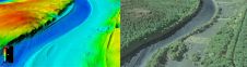
The US Geological Survey (USGS) and Dewberry have jointly released a new topobathymetric Lidar dataset for the Potomac River, extending from the Potomac Highlands in West Virginia to the Chesapeake...
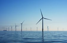
No matter which form it takes, energy is a basic necessity. Here, we focus on the survey requirements for installing windfarms, commissioning and decommissioning platforms, and laying pipelines and cables....
The implementation of the new IHO hydrographic geospatial standard for marine data and information, the S-100 product family, presents significant challenges that require coordination between the IHO, the industry involved...
EdgeTech, a leader in high-resolution sonar imaging systems and underwater technology, has increased the standard depth rating to 3,000 metres on all new 2050 combined tri-frequency sidescan sonar and high-resolution...
This site uses cookies. By continuing to use this website, you agree to our Cookies Policy. Agree