
Hi-Target Introduces Upgraded Dual-frequency Echosounder
Hi-Target released its latest hydrographic product, a dual-frequency single-beam echosounder, on 25 May 2022. According to the Hi-Target products center deputy director Adin Lee: “The previous version of the HD-MAX is our classic echosounder, serving many users around the world. As well as the positive feedback from users, there have been mounting calls for the addition of low-frequency to the HD-MAX. We have listened and responded, but waited with the release until we could be sure that the performance will satisfy the users and project supervisors, in return for their trust. Now is the right time.”
The new model has the same name, HD-MAX, but its performance and specifications in challenging scenarios distinguish it different from its single-frequency predecessor.
Lee continues: “We have not simply added low-frequency components and related algorithms to make it workable. We did not stop at version 1, but continued improving the stability and reliability, while also expanding the compatibility. The new HD-MAX can operate with a wide range of frequencies, from 100kHz to 750kHz in the high-frequency channel and from 10kHz to 50kHz in the low-frequency channel, as long as it is supported by a transducer.”
The HD-MAX dual-frequency echosounder brings extraordinary benefits to users in the following three kinds of scenarios: sediment measurement for dredging projects, hydrographic surveys in high sediment content rivers and seafloor bathymetry.
Sediment Measurement and Dredging
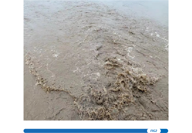
Surveying and determining the thickness and distribution of sediment is always necessary for pre-dredging work. As a lower frequency signal will not return to the surface of the seabed until it reaches a harder layer beneath, but a high-frequency signal is reflected from the seabed surface, the thickness of sediments can be calculated by analysing the differences in depth from different signals. The data can be processed with the user’s software to create a sediment distribution map with thicknesses in different colours.
Measurement in High Sediment Content Water
Although the depth result given by low-frequency signals is not as accurate as that by high-frequency signals, the penetrating advantage of longer wavelengths is of irreplaceable value to surveyors when conducting bathymetry in rivers with a high sediment content. With the help of the low-frequency signal and the optimized algorithm, the new HD-MAX has proven its reliability in the Yellow River, China, which is famous for its high sediment content.
Seafloor Bathymetry
While many hydrographic projects are inland and offshore where depth is not an issue, some projects take place at deeper sites such as Lake Baikal and other similar lakes and reservoirs, or even on the open sea, where the depth varies from 600 to 2,000 metres or even much deeper. In such cases, obtaining a reliable depth is crucial.
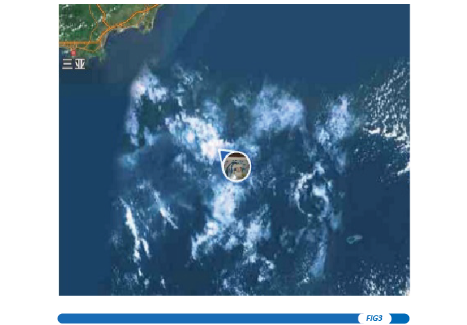
Take the South China Sea as an example; as the western part of the Pacific Ocean, it is the largest and deepest sea along the Chinese coast. The average depth is 1,212 metres, while the deepest part can reach 5,559 metres. The continental shelf is at depths of 100 to 3,200 metres, and the slope surface is undulating and the environment complex. The classic echosounder can only measure within a 300-metre range, and is therefore not an ideal choice for ships in the deep sea.
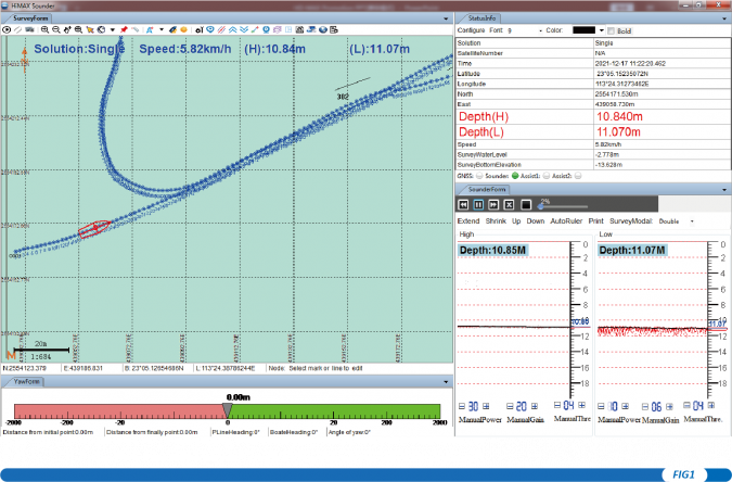
To test the echosounder, we headed out to the deep ocean, to check whether it really could operate at the theoretical vaue of around 2,000 metres.
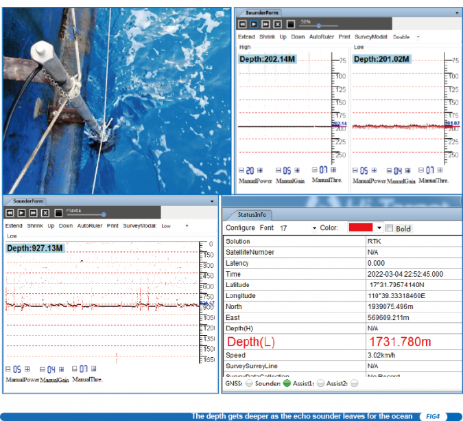
As the ship sailed away from dock and headed into the deep ocean, the depth gradually increased, from around 20 to 200 metres. Then, on the second day, the depth increased to around 900 metres. At this depth, only the low-frequency signal returned a depth value. As the ship continued, the depth value changed rapidly from 1,700 to 1,900 metres, as it moved over the continental shelf. These results testify to the performance of the new HD-MAX echosounder for seafloor measurement. As Adin Lee explains: “It means that the new echosounder can ideally work from shallow to the deep. Our users can make better use of their budget as the new HD-MAX echosounder can be used in more scenarios.”
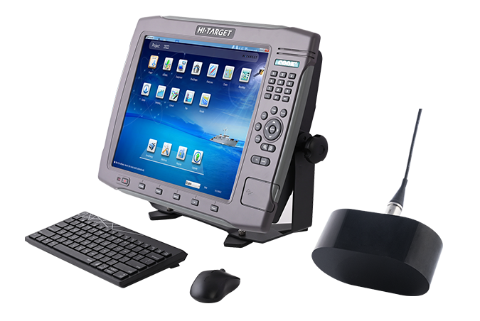
Product Overview
The HD-MAX dual-frequency echosounder can be used in a wide range of scenarios, from sediment measurement for dredging to bathymetry in high sediment content water and for depth measurement projects in shallow, deep or very deep water. The fully-featured HiMAX Sounder hydrographic software integrates bathymetry, navigation and post-processing.
Moreover, equipped with a 17″ large screen and industrial computer platform, HD-MAX offers a set of reliable solutions for hydrographic offices around the world, with a robust dual-frequency transducer and a user-friendly survey pole.
About Hi-Target
Established in 1999, Hi-Target is the first professional high-precision surveying and mapping instrument brand to be successfully listed in China. Hi-Target provides a wide range of surveying equipment including GNSS receivers, CORS stations, total stations, 3D laser scanners, GIS data collectors, UAV/UAS and hydrographic products to offer complete solutions for various industries. As the leading brand in the geospatial industry, Hi-Target invests heavily to bring the latest positioning technology and innovation.
For over 20 years, Hi-Target has had approximately 3,300 employees worldwide, with a network of 28 subsidiaries, 28 branches and more than 200 partners in over 60 countries to service and support our customers.

Value staying current with hydrography?
Stay on the map with our expertly curated newsletters.
We provide educational insights, industry updates, and inspiring stories from the world of hydrography to help you learn, grow, and navigate your field with confidence. Don't miss out - subscribe today and ensure you're always informed, educated, and inspired by the latest in hydrographic technology and research.
Choose your newsletter(s)


