Hydrographers in the Liberation of the Philippines’ Charted Waters
Following the capture of Morotai in the Dutch East Indies, the stage was set for the invasion of the Philippine Islands. The liberation of the Philippines was a blur of manoeuvre with General Douglas MacArthur sending prongs almost simultaneously north, south and west from October 1944 until near the end of the war. Three major landings were made: Leyte Gulf, Mindoro and Lingayen Gulf between 17 October 1944 and 6 January 1945. Numerous smaller landings were made as well over the next eight months.
Although the Philippine Islands are comprised of over 7,000 islands studded with coral reefs and labyrinthine passages, the United States Coast and Geodetic Survey had been on the islands for forty years prior to the outbreak of hostilities. Because of this, the islands were covered by a full suite of modern charts coupled with knowledge of tides and tidal currents. This knowledge contributed to the selection of landing sites and the planning of landing operations.
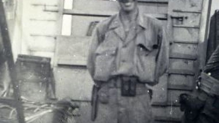
As in New Guinea, Coast and Geodetic Survey hydrographers assigned to the 2nd and 4th Engineer Special Brigades made many outstanding contributions to amphibious operations in the Philippines. They conducted hydrographic surveys, landed on enemy-held beaches to conduct reconnaissance surveys prior to invasion, piloted assault vessels, served as beachmasters, and facilitated the offloading of critically needed fuel and supplies. Many of these operations were conducted on beaches disputed by enemy forces and under the threat of the newly instituted kamikaze suicide attacks and attack by conventional aircraft. Five officers transferred from the Coast and Geodetic Survey made particularly significant contributions during the liberation of the Philippines. These men were: William Tucker, hydrographer of the 2nd Engineer Special Brigade (ESB); Francis Popper, regimental navigator of the 532nd Engineer Boat and Shore Regiment (EBSR); Ross Gilmore regimental navigator of the 544th EBSR; Harry Garber, regimental navigator of the 542nd EBSR; and Ernest Lewey, regimental navigator of the 594th EBSR.
First landings in the Philippines occurred on 17 October 1944, with attacks on the islands marking the eastern approach to Leyte Gulf. Three days later, Douglas MacArthur fulfilled his pledge to return when he stepped off the ramp of a 2nd Engineer Special Brigade LCVP shortly after 1400 hours on Leyte Island. At that time, Lieutenant Colonel William Tucker and Lieutenant Francis Popper were helping unload supplies on the beaches of Leyte. The next day Tucker led a reconnaissance into Cancabato Bay and the still occupied Tacloban that discovered an intact pier with sufficient water depth to unload liberty ships. This was the first intact pier seen since Australia so he immediately began surveying the bay to find a channel into the pier. He obtained Popper’s help and set him to work helping buoy and mark the channel. Over the next two days, 200 miles of sounding lines were run and the deepest channel, 21 feet at low water, was found and marked by 12 temporary buoys. The hydrographic unit Tucker commanded consisted of 2 officers and 10 enlisted men. The unit’s equipment consisted of one 45-foot picket boat equipped with depth recorder and radar, an LCVP, one 26-foot motor tug equipped with depth recorder and one converted Japanese barge used as quarters and kitchen for the unit. Two days after completing the survey, Tacloban was secured and Tucker piloted the first two liberty ships into the pier. Over 1,000 tons of cargo were unloaded the first day and this was increased to 3,000 tons per day as unloading facilities and warehouses were obtained.
Leapfrogging up the islands, 15 December marked the landings on Mindoro. Over the next two weeks, numerous ships in supply convoys were damaged severely or sunk by the ‘Divine Wind’ or ‘Floating Chrysanthemums’ as the Kamikaze pilots were known. While under the onslaught of repeated Kamikaze and torpedo bomber attacks, Francis Popper was cited for working “tirelessly night and day in the fueling and placing of aviation gas barges to the jetties. Due to his efforts there never was a shortage of aviation gas at a very critical period.” On 18 December, Popper proceeded by picket boat from Mangarin Bay to San Agustin and “observed a squadron of motor torpedo boats being attacked by an enemy plane. The enemy pilot dived on a boat, hitting it amidship, exploding it in flames, and spreading burning gasoline over the surrounding waters. … Popper turned his boat into the burning wreckage, and aided by his crew pulled the wounded survivors from the water ....”
On 28 December, Popper found out what it was like to feel the hot wind from the explosion of the ammunition ship John Burke, which was two miles away from gasoline tanker he was offloading. Shortly after the Burke exploded a Japanese torpedo bomber approached the tanker and dropped its torpedo, which skipped on the surface and jumped over the deck of the ship. It merely broke a boom as it passed. A month later, Popper volunteered to conduct a pre-landing reconnaissance of the Palawan coast with three other engineers. This was particularly dangerous as there were 1,800 Japanese troops in close proximity to the landing site near which over 140 American prisoners of war had been burned alive two months before. He contacted local Filipino guerrillas who brought the four ashore in native craft. He reconnoitred several miles of shoreline and gathered information which led to changing the entire scheme of manoeuvre for the 28 February landings. It is probable that he would have been tortured and killed if captured.
After Mindoro, the next major landings occurred on the island of Luzon at Lingayen Gulf. Ross Gilmore left the Bougainville staging area on the Australian LSI Westralia on 12 December. The Westralia was nearly a month in transit and took a kamikaze close astern on 8 January that jammed the rudder. The next day, Gilmore took part in the Lingayen Gulf landings and arrived at Yellow-Crimson Beach at H +16 minutes. Shortly thereafter, the Navy beachmaster was seriously injured by an exploding ‘short’ from a US ship and Gilmore, who was standing only a few feet away, took over as beachmaster and boat-control officer for that beach. On S +1 day, the wind and surf came up and landing craft were swamped and smashed by the dozens and two LSTs (landing ship tank) were set broadside on the beach. Gilmore took matters into his own hands and made a hasty hydrographic investigation of the nearby Dagupan River. He then piloted LCMs (landing craft) into Dagupan for unloading. During the course of this operation, Gilmore negotiated with the captains of about a dozen Navy LSTs, whose flotilla commander had not arrived, into working for him as a lightering group. This greatly increased the efficiency of the unloading operations. These vessels continued working for Gilmore for the next 2 months. Within a month, American troops were on the doorstep of Manila.
The Battle of Manila was as fierce as any of the urban fighting of the European theatre. It was said that of all Allied cities only Warsaw was more devastated. 30,000 Japanese sailors and marines had been ordered to destroy all port facilities and naval warehouses. They then proceeded to rape and pillage the city killing at least 100,000 civilians. This holocaust lasted from 3 February 1945 until 4 March 1945. While this battle was going on, the recapture of Corregidor Island occurred. Corregidor, known as ’The Gibraltar of the East’, guarded the entrance to Manila Harbor. Perhaps one of the greatest hydrographic feats of the war occurred during this operation. On the morning of 16 February 1945, a joint Army-Navy expedition left Subic Bay to attack Corregidor by sea while 2,000 paratroopers landed ‘Topside’. The Naval Force Commander was concerned about the suitability of the landing beach. William Tucker, accompanying the 592nd EBSR on this action, went onto the beach in a regimental crash boat to obtain the needed hydrographic information. The boat, being fast with shallow draft, proceeded to the beach under heavy enemy machine gun fire from both sides of the cove. Mortar fire was falling on the beach at the same time. Tucker supervised the soundings and determined that the beach was suitable for landing. During the 7 minutes that the boat was under machine gun fire, Tucker occupied an exposed position near the bow. All units involved in the Corregidor operation were awarded a Presidential Unit Citation that read: “Their magnificent courage, tenacity, and gallantry avenged the victims of Corregidor of 1942, and achieved a significant victory….” After Corregidor was secure, the first Allied shipping was able to pass into Manila Harbor on 1 March.
From 22 to 24 February, at the height of the battle for Manila, Ernest Lewey conducted “the initial hydrographic survey of Manila Harbor prior to opening this important port for military operations. Despite extreme personal risk from rifle, mortar, and machine gun fire directed by enemy troops from concealed positions on shore, and on piers, jetties, and partly submerged vessels in the harbour, he led this hazardous survey for three days and nights until the objective area was explored and mapped for the safe anchorage and servicing of ocean-going cargo vessels....” Following his survey, Lewey piloted the first ships to come into Manila Harbor following the fall of Corregidor and served as harbour pilot for the next month.
While the Battle of Manila was raging, Harry Garber was involved in a number of small amphibious actions including Biri, Capul, and Naranjo. This operation extended over an area of one hundred miles of narrow treacherous and inside straits for which Garber was cited for his “skilful navigation, thorough knowledge of currents, and sound judgement”. In late March, he participated in actions at Panay and Negros Islands. Here he made hydrographic history as he was the first C&GS officer to use an electronic navigation system. He conducted a night-time offshore survey of an enemy held beach off Pulupandan by using radar ranges and bearings, an early form of range-azimuth surveying.
The five hydrographers noted above received a total of eight medals, one letter of commendation, and one Presidential Unit Citation. They made contributions far in excess of their numbers to the success of Allied operations in the Philippines. Their versatility and pre-war experiences allowed them to undertake the roles of navigators, hydrographers, ship pilots, beachmasters and staff officers engaged in planning landing operations. Perhaps only a small part of the mighty armadas that liberated the Philippines, nevertheless, they contributed greatly to fulfilling MacArthur’s pledge to return to the Philippine Islands.

Value staying current with hydrography?
Stay on the map with our expertly curated newsletters.
We provide educational insights, industry updates, and inspiring stories from the world of hydrography to help you learn, grow, and navigate your field with confidence. Don't miss out - subscribe today and ensure you're always informed, educated, and inspired by the latest in hydrographic technology and research.
Choose your newsletter(s)


