How to choose the right hydrographic processing software
When looking to buy hydrographic processing software, it is important to establish the requirements in order to find the best software for the job at hand. The users’ technical skills,...
When looking to buy hydrographic processing software, it is important to establish the requirements in order to find the best software for the job at hand. The users’ technical skills,...
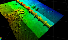
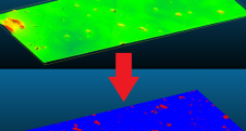
Seafloor pipelines are a critical infrastructure for oil and gas transport. Timely inspection is required to verify their integrity and determine the need for maintenance, as failures in these pipes...

In this interview, Harald Sternberg, Professor of Hydrography and Geodesy at HafenCity University, shares his thoughts on the key market trends, technology drivers and challenges, and the impacts of COVID-19...
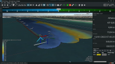
Autonomous operations – in particular automation and remote control – can help achieve low-carbon hydrographic operations while saving time and costs. However, the advanced software features needed to achieve autonomy...

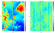
Pedro Menandro is PhD candidate (MBES multispectral backscatter data for seabed classification) in Oceanography at Universidade Federal do Espírito Santo (Brazil). Currently works on habitat mapping using different datasets, exploring...
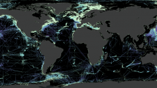
Over the last few centuries, mapping the ocean seabed has formed a major challenge for marine geoscientists. Ocean bathymetric charts and submarine geomorphology have significantly impacted our understanding of our...
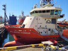
The key objective was to make a rapid and accurate determination of the source of the diesel and oil that had appeared on the ocean’s surface. The company carried out hydrographic survey work using a Norbit Winghead i77h multibeam echosounder (MBES) system. An oil slick was seen on the surface of Nootka Sound and staining on rocks of nearby Bligh Island, west of Vancouver Island, Canada, in late 2020. This set in...
While online data acquisition is of course of the utmost importance in hydrography, technological developments mean that modern surveyors also need to know about data science, machine learning and artificial...
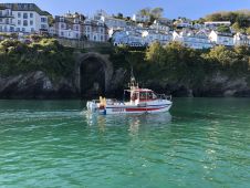
LandScope Engineering’s multipurpose survey vessel Investigator has recently completed a marine geophysical survey in Looe Bay, Cornwall, UK, in support of breakwater and pier development works. High-resolution UAV photogrammetric data...

OceanWise has announced that, as of 1 November 2021, the RSOBIA toolbar is available free of charge. The software tool, which takes raster imagery and segments the data into geographic...
This site uses cookies. By continuing to use this website, you agree to our Cookies Policy. Agree