StarFish v2.0
Tritech International Ltd announce the launch of the new StarFish, Scanline V2.0 Software. StarFish is a side-scan sonar which produces images of the seabed and has improved capabilities. Tritech are...
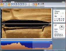
Tritech International Ltd announce the launch of the new StarFish, Scanline V2.0 Software. StarFish is a side-scan sonar which produces images of the seabed and has improved capabilities. Tritech are...
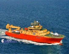
General Robotics is shipping DeepLive 2.0, its real-time data input module. The first customer is DeepOcean AS for its new Inspection, Maintenance & Repair (IMR) vessel, the Edda Fauna which...
Twenty years ago, Norcom Technology first began to develop their bespoke software for the hydrographic industry. The company started by Phil Harris in 1986 employed just one other computer programmer,...
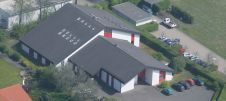
Together with customers, friends and family, Helzel Messtechnik celebrated its 20th anniversary on 16 October 2015 at its headquarters in Kaltenkirchen, Germany. Founded in 1995 by Thomas Helzel and Matthias Kniephoff, the...

Over 120 members and guests from at home and overseas attended the reception celebrating the 20th anniversary of the International Marine Contractors Association (IMCA) on 19 May 2015. The reception...

Hydromea, a pioneering leader in subsea technology, has announced a significant advancement in underwater propulsion with the successful completion of a demanding pressure test on its deep-rated ultra-thin Diskdrive thrusters....
HydroService AS announces release of dKart Editor - Additional Military Layers module, with full support all defined product specifications defined by the newly released AML Version 2.0. Together with a...
ATLAS Hydrographic in Bremen has received an order from the Finnish Naval Research Institute in Helsinki for a 200 kHz Fansweep 20 shallow water multibeam system for installation aboard a...

The Marine Geoscience Research Group at University College Cork, under the aegis of the Irish Marine Institute, has published the first high-resolution geomorphological map of most of the Irish continental...
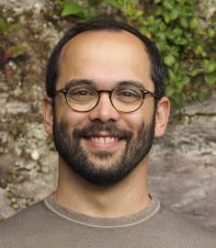
Riccardo Arosio is a marine geologist and postdoctoral researcher at University College Cork in the Marine Geosciences Research Group. Riccardo’s research focuses on the use of geomorphometry and machine learning...
This site uses cookies. By continuing to use this website, you agree to our Cookies Policy. Agree