CARIS Asia Pacific Users Conference
This was the first time CARIS had hosted its International Users Group Conference on 5th -9th March 2007 in Asia. Having delivered the event to various cities in North America...
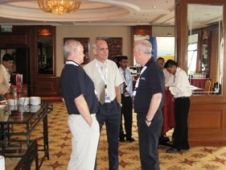
This was the first time CARIS had hosted its International Users Group Conference on 5th -9th March 2007 in Asia. Having delivered the event to various cities in North America...

The UKHO celebrated the second World Hydrography Day with a gala dinner based on the theme "Electronic Navigational Charts (ENCs) essential to safety of life at sea". On show at...
A growing problem exists with forward-deployed electronic chart display and information systems (ECDIS) in obtaining and updating geospatial data(electronic nautical charts). This problem is commonly referred to as distributing geospatial...
The UK Hydrographic Office is making available as a free download from its website a guide to electronic charts and chart carriage requirements which is an essential tool for all...
Two electronic charting services developed by the UK Hydrographic Office (UKHO) will beunveiled at the Europort Maritime exhibition. The services will further strengthen UKHO's commitment to the Safety Of Life...
The UK Hydrographic Office's distributors network can now receive a permit for ENCs online in less than 10 minutes. This improvement to the UKHO's digital licensing and ordering service now...
An electronic chart service designed to ease paper chart users into the digital age will be showcased by the UK Hydrographic Office (UKHO) at the Marintec China show. The Admiralty...
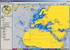
The UK Hydrographic Office's Admiralty ENC and ECDIS services continue their major expansion with over 6,500 ENC cells now available worldwide and with a further 1,000 cells scheduled to be...
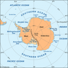
The Scientific Committee on Antarctic Research (SCAR) expert group for the compilation of the new International Bathymetric Chart of the Southern Ocean (IBCSO) proposes to build a consistent bathymetric database...

Students from six different countries were the latest to learn how to produce and maintain Electronic Navigational Charts (ENC) by attending an intensive five -week course delivered by UKHO's staff....
This site uses cookies. By continuing to use this website, you agree to our Cookies Policy. Agree