First Seabed Sonar to Measure Marine Energy Effect
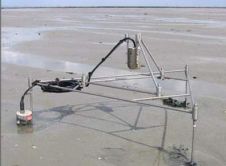
UK scientists will measure the effect on the marine environment and wildlife of devices that harness tide and wave energy using sonar technology that has, for the first time, been...
UK scientists will measure the effect on the marine environment and wildlife of devices that harness tide and wave energy using sonar technology that has, for the first time, been...
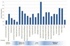
More and more users are demanding bathymetry to support many new and different applications. New applications have necessitated changes in data acquisition and processing technologies to meet user requirements. The...
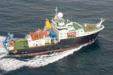
A voyage to find out what happens to seabed fauna in a deep-water trawling area if you leave it undisturbed several years got underway on 9th May 2011. The RRS...
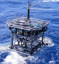
German marine research centre, GEOMAR, have placed an order for HyBIS, an underwater inspection and sampling vehicle, from UK subsea tooling and manipulator manufacturers, Hydro-Lek Ltd. The GEOMAR system will...

Esri chief scientist Dawn J. Wright, PhD, has received the Association of American Geographers (AAG) Presidential Achievement Award. Presented at the AAG annual meeting on 28th February 2012, the award...

Optech has released the airborne Optech CZMIL Coastal Zone Mapping and Imaging Lidar system, an airborne coastal zone mapping system producing simultaneous high-resolution 3D data and imagery of the beach...
It has been a busy period for Fugro Renewable Services, and the company is exhibiting at the Husum WindEnergy exhibition in Husum, Germany, from 18 to 22 September 2012. The...
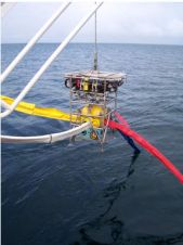
The versatility of Hydro-Lek’s HyBIS robotic underwater vehicle has been further demonstrated in the deployment of Ocean Bottom Seismometers (OBS) and Ocean Bottom Electromagnetic Receivers (OBEM) on the seafloor in...
Partrac, UK, has introduced the Genesis Altimeter, a technology designed to measure small-scale changes on seabed elevation levels. The device takes high-resolution measurements of sediment erosion and deposition on the...
The full feature is online at http://member.hydro-international.com/. Please subscribe for free using the Subscribe button in the left hand column. Peter Harris outlines how hydrography contributes to marine science. Seafloor...
This site uses cookies. By continuing to use this website, you agree to our Cookies Policy. Agree