Jesse Varner
Jesse Varner has been a GIS specialist at NOAA's National Centers for Environmental Information (NCEI) in Boulder, Colorado for 12 years. He has a degree in Computer Science from the...

Jesse Varner has been a GIS specialist at NOAA's National Centers for Environmental Information (NCEI) in Boulder, Colorado for 12 years. He has a degree in Computer Science from the...
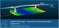
Even in the difficulty times facing society today, training does not stop, as demonstrated by the 'MEMS Technology – Presentation and Hydrographic Application' conference held by video conference on 26...
“It wasn’t always easy being a black woman in my early days as an oceanographer,” says Dawn Wright, chief scientist at a worldwide operating company specialized in mapping and spatial...
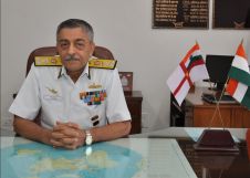
The 2019 Alexander Dalrymple Award has been presented to Vice Admiral Vinay Badhwar, national hydrographer to the Government of India, in recognition of his outstanding contribution to Indian hydrography and hydrography across...
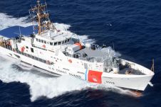
Navico, parent company to the Lowrance®, Simrad®, B&G® and C-MAP® brands has signed a 5-year agreement with the United States Coast Guard (USCG) to provide C-MAP cartography under the USCG’s Small Boat Product...

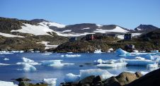
Fausto Bravo is a lieutenant in the Chilean Navy, specifically in the Hydrographic and Oceanographic Service and he would like some advice. "In December 2019, one of Chile's air force planes...

The Australasian Hydrographic Society (AHS) has announced that applications are now being received for the Society’s 2020 Education Award. The $3,500AUD award is provided to a student whose study - in...
Denmark has challenging seascapes to map and chart. It has a rich history of nautical charting that dates back to the seventeenth century, and many of its navigational products for...

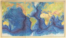
Jamie McMichael-Phillips, the new director of The Nippon Foundation-GEBCO Seabed 2030 Project, has now taken up his position in leading one of the most challenging projects of the next decade,...
C-MAP, a leader in digital marine cartography and cloud-based mapping has released new C-MAP Reveal charts, featuring views of the seafloor. This cartography offers all the navigation data and capabilities...
This site uses cookies. By continuing to use this website, you agree to our Cookies Policy. Agree