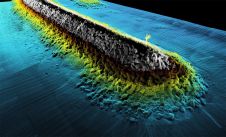
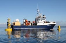
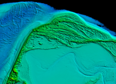
Found 400 results
Sort by

Machine learning as a tool

Machine learning is currently experiencing a surge of interest. Of course, what first come to mind are self-driving cars, face recognition and internet algorithms. However, while these are great examples...

Read more

Welcome to the New Geospatial

Teledyne Optech and Teledyne CARIS have united to form Teledyne Geospatial in response to evolving marketplace needs. Under the Teledyne Imaging group, the harmony between the two business units is...

Read more

Bedrock Launches Ocean Exploration and Survey Platform

Bedrock, a vertically-integrated sea-floor data platform and service, has announced the launch of its full-service offering: autonomous ocean surveys powered by the company’s proprietary, 100% electric autonomous underwater vehicle (AUV) and Mosaic, a...

Read more

Who is going to map the high seas?

To achieve the aggressive goals of Seabed 2030, uncrewed survey systems must be used to augment more traditional ocean mapping efforts, particularly on the high seas. In addition to providing...

Read more