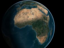
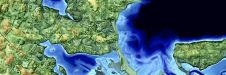
Mapping Africa's Seafloor
A two-part webinar series entitled ‘Mapping the Seafloor around Africa’ was jointly organized by the IOC-UNESCO Sub-Commission for Africa and the Adjacent Island States (IOCAFRICA) and the Nippon Foundation-GEBCO Seabed...
A two-part webinar series entitled ‘Mapping the Seafloor around Africa’ was jointly organized by the IOC-UNESCO Sub-Commission for Africa and the Adjacent Island States (IOCAFRICA) and the Nippon Foundation-GEBCO Seabed...
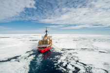
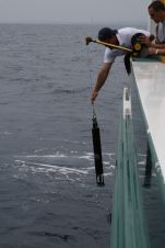
Working in the ocean environment can be challenging and dangerous. It requires skilled professionals using cutting-edge technology to measure and map the physical features of the underwater environment, whether for navigational safety, coastal zone management, mapping of physical structures or seabed topography. Often, data is collected in remote locations or locations with unpredictable and harsh weather conditions. Working in the ocean environment can be challenging and dangerous. It requires skilled professionals using cutting-edge technology to measure and map the physical features of the underwater environment, whether for...
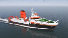
Kongsberg will supply Germany’s forthcoming 125-metre ocean research vessel, Meteor IV, with a range of highly advanced scientific sensors and handling equipment. Scheduled for launch in 2026, Meteor IV is...
On 24 January 2023, the European Union declared the Galileo High Accuracy Service (HAS) operational for testing, and it is scheduled to become fully operational in 2024. This free signal adds...
This article describes the internship programme that has been offered during six years while performing maritime archaeological projects in the Mediterranean. This collaborative effort between academia and industry provides affordable manpower,...
A team of researchers from the University of New Hampshire recently made a groundbreaking discovery in Lake Huron. They were part of a world-renowned team that found an intact shipwreck...
The need to build a grand coalition of mapping partners all over the world, from all corners and professions of the maritime community, is more urgent now than ever. During...
26 April to 30 May - Hydro International proudly presents the Shallow Water and Coastal Mapping Weeks, which will immerse you in experiences, tools and advances in mapping shallow water...
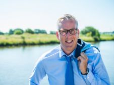
David Millar is Fugro’s government accounts director for the Americas, based in the Washington DC area. He oversees the development and execution of partnerships with national governments, the United Nations,...
This site uses cookies. By continuing to use this website, you agree to our Cookies Policy. Agree