The search for the Montevideo Maru
Fugro has utilized its cutting-edge hydrographic technology in Australia to locate the final resting place of the Montevideo Maru, which sank in 1942 with more than 1,200 people on board....

Fugro has utilized its cutting-edge hydrographic technology in Australia to locate the final resting place of the Montevideo Maru, which sank in 1942 with more than 1,200 people on board....
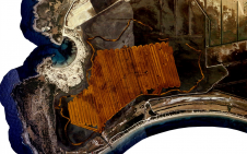
Sulmara recently successfully completed an unexploded ordnance (UXO) and multibeam (MBES) survey of Ardersier Port, Scotland. The port is currently undergoing a significant regeneration project involving construction and dredging to...
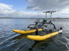
Unmanned surface vehicles (USVs) are increasingly being used for the mapping and management of shallow-water environments such as lagoons, rivers and estuaries, due to their economic and ecological benefits. The...

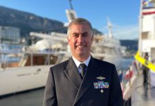
Renewable energy and the pivotal role of hydrography in offshore development take centre stage in a captivating interview with Professor Ed Hill, chief executive of the National Oceanography Centre (NOC)....
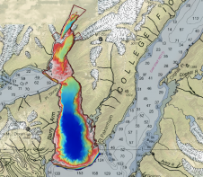
Alaska’s history of devastating landslides and tsunamis creates challenges in assessing communities’ risk without water depth data at the base of unstable slopes. To address this, the US Geological Survey...

The use of Lidar in the offshore wind industry is providing valuable insights into avian interactions with wind turbines. Lidar technology has already made its way into consumer devices such...
Hydro International interviewed RDML Benjamin Evans, director of NOAA’s Office of Coast Survey. Evans is responsible for overseeing the mapping and charting of all US coastal waters, as well as...
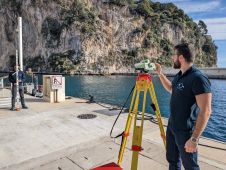
Underwater positioning with USBL can be accurate in favourable environments. However, it’s often perceived as less precise than land-based positioning. Maintaining high accuracy during mobilization and calibration is crucial. If...
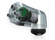
Exail, a global leader in high-performance subsea inertial navigation systems (INS), recently launched the Rovins 9 DVL, an innovative all-in-one system that combines the strengths of inertial navigation and Doppler...
In many places around the world, data clearly shows a rise in sea level. In low-lying coastal areas, even small increases when coupled with high tides and storm surges can...
This site uses cookies. By continuing to use this website, you agree to our Cookies Policy. Agree