Observing the ocean together
Collaborating and coordinating are two very important tasks of EuroGOOS, the European Global Ocean Observing System, located in Brussels. The member organizations work together to...
Collaborating and coordinating are two very important tasks of EuroGOOS, the European Global Ocean Observing System, located in Brussels. The member organizations work together to...
Renewable energy and the pivotal role of hydrography in offshore development take centre stage in a captivating interview with Professor Ed Hill, chief executive of the National Oc...
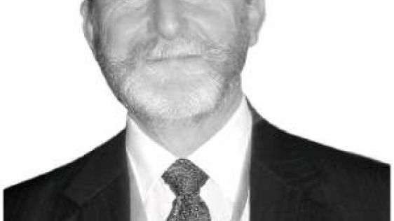
Hydro International interviewed RDML Benjamin Evans, director of NOAA’s Office of Coast Survey. Evans is responsible for overseeing the mapping and charting of all US coastal...
The implementation of the new IHO hydrographic geospatial standard for marine data and information, the S-100 product family, presents significant challenges that require coordinat...

HafenCity University in Hamburg is one of the most thriving European Universities with a Specialisation in Hydrography. Professor Markéta Pokorná has been named professor of hydrog...
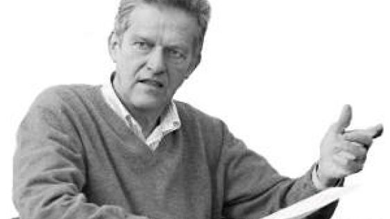
With the recent takeover of Sweden-based Airborne Hydrography, Leica Geosystems is set to gain a stronger foothold in the hydrographic market. Hydro International interviewed Jürge...
The RIEGL laser scanner company has been innovating laser scanning technology for more than 30 years. The equipment can be found in the most remote and even challenging locations a...
Durk Haarsma Publishing director, Hydro International Continue reading the whole article
Hydrographic surveying still requires skilled people. The profession itself is carried out across the world and performed in different fields. Whether the profession involves envir...
Since the introduction of the IMO resolution on having ECDIS systems on board Solas vessels the demand on technological advancements on ECDIS systems has grown. Dr. Nikolay Lebedev...
This article is fully available at http://member.hydro-international.com/. Surveying a coastline of 102,000km and sea surface of 2.3 million km2 to make safe navigation possible i...
The field of geodesy is undergoing a revolutionary change. The developments of the last few decades have altered the views and work of professional surveyors, researchers and devel...
The full feature is online at http://member.hydro-international.com/. Please subscribe for free using the Subscribe button in the left hand column. Peter Harris outlines how hydrog...
Robert Ward took over the presidency of the IHO from Vice Admiral Alexandros Maratos in September. President Ward was elected by the Member States of the Organisation at their five...

Deep ocean minerals are the future resources for the common heritage of mankind as other natural resources are becoming depleted. The International Seabed Authority is an autonomou...

The rate of data growth is climbing exponentially, thanks to new sensors, new social networks and new ways to create and capture data. In response, Oracle is tackling four issues o...

Brest is the biggest supplier of highly qualified hydrographers in Europe with more than 30 graduates per year and growing. Can you explain the success of ENSTA? The success of E...

Almost 50 years in hydrography gives you insight and authority to talk about the field and the changes it has gone through in half a century. Rear Admiral Christian Andreasen talks...
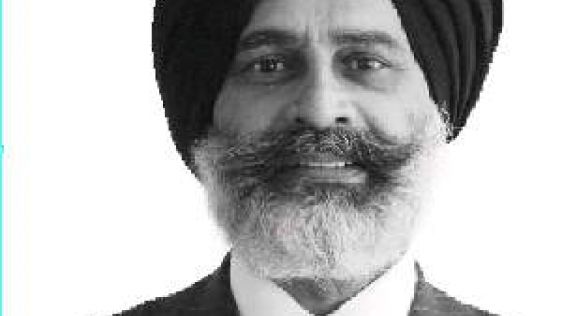
Gurpreet Singhota is Deputy Director/Head of the Operational Safety Section within the Maritime Safety Division of the International Maritime Organisation (IMO) and will therefore...
Every five years, tensions at the International Hydrographic Conference in Monaco rise to a maximum, when the Member States of the IHO gather to vote for the three director positio...
The International Tribunal for Law of the Sea is a judicial body, seated in Hamburg, but unlike the International Court of Justice in The Hague, specialised in the field of the law...

Surveying, charting and monitoring a complex and vast area which includes features from rivers, waterways, a long Atlantic coast to the Antarctic Peninsula environment, is a very c...

The coastal zone is immensely important for humankind, marine and coastal spatial planning is a vital tool for planning and preserving the world’s coasts. Ron Furness, is a nautica...
Hydrographers need to step up and fill the I in ECDIS, says Michael Casey, vice president Geospatial Systems at IIC Technologies and prior to that director for Nautical Charting at...

A schizophrenic interest in both ocean engineering and the ocean’s record of climate history led Larry Mayer, director, Center for Coastal and Ocean Mapping (CCOM), co-director, Jo...

Having learned of the tremendous effort made by the Maritime Authority of Suriname, led by Mr Michel Amafo, in developing its hydrographic service, Hydro International now has the...

This site uses cookies. By continuing to use this website, you agree to our Cookies Policy. Agree