Surveying beyond navigation
Hydro International interviewed RDML Benjamin Evans, director of NOAA’s Office of Coast Survey. Evans is responsible for overseeing the mapping and charting of all US coastal waters, as well as...
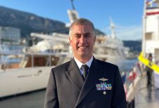
Hydro International interviewed RDML Benjamin Evans, director of NOAA’s Office of Coast Survey. Evans is responsible for overseeing the mapping and charting of all US coastal waters, as well as...
An estimated 95% of the oceans remains unexplored today, implying a huge market opportunity for innovative marine survey solutions. While the boom in offshore renewables projects will certainly continue, the...
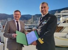
During the recent 2023 International Hydrographic Organization (IHO) Assembly, Secretary General Dr Mathias Jonas announced the signing of a Memorandum of Understanding (MoU) between the IHO and the United States’...
In many places around the world, data clearly shows a rise in sea level. In low-lying coastal areas, even small increases when coupled with high tides and storm surges can...
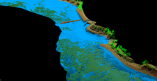
A decade after completing its first shoreline mapping project, NV5 Geospatial has mapped over 10.5 million hectares of North America’s shoreline and riverine environments for more than 200 projects. These...

Seabed 2030 is rapidly approaching its ultimate objective of mapping the entire seabed within seven years. To achieve this goal, the project is actively seeking donations of both public and...
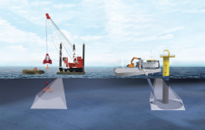
Amid new climate policies, the global energy transition is in full swing. This is leading companies and organizations to take a variety of measures to make their business operations more...
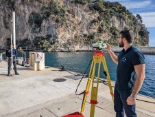
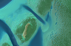
As part of a Catalan government project to improve the management of its marine environment, ICGC cooperated with Field to use airborne Lidar bathymetry (ALB) to survey the Catalan coastal...
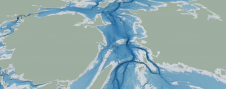
The Denmark Depth Model (DDM) is a digital bathymetric model covering Denmark’s exclusive economic zone (EEZ). It was developed based on hundreds of bathymetric survey datasets and historical sources and...
GEOMOD is a software development company specialized in marine geomatics and hydrography. Since 2004, we have been building our expertise on hydrographic products dedicated to mariners, harbour workers, and hydrographic...
This site uses cookies. By continuing to use this website, you agree to our Cookies Policy. Agree