Found 223 results
Sort by

Terradepth

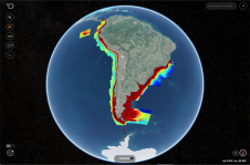
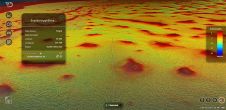
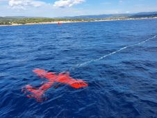
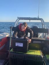
Terradepth is an ocean data-as-a-service company focused on scaling ocean data collection and dissemination, enabling unprecedented exploration of the underwater environment. Their unique end-to-end solutions increase maritime operational efficiency with...

Read more

TCarta to Showcase SDB Products at GEOINT 2022

TCarta Marine, the Colorado-based provider of hydrospatial products, will present its satellite-derived bathymetric (SDB) data sets on Terradepth’s Absolute Ocean visualization platform for the first time at GEOINT 2022. Additional...

Read more

Challenging Marine Geophysical Survey in Looe Bay

LandScope Engineering’s multipurpose survey vessel Investigator has recently completed a marine geophysical survey in Looe Bay, Cornwall, UK, in support of breakwater and pier development works. High-resolution UAV photogrammetric data...

Read more