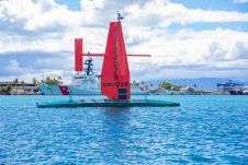
Who is going to map the high seas?
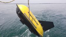
To achieve the aggressive goals of Seabed 2030, uncrewed survey systems must be used to augment more traditional ocean mapping efforts, particularly on the high seas. In addition to providing...
To achieve the aggressive goals of Seabed 2030, uncrewed survey systems must be used to augment more traditional ocean mapping efforts, particularly on the high seas. In addition to providing...
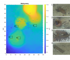
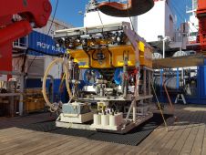
The detection of unexploded ordnance (UXO) in the sea is a demanding task. UXO survey data is acquired using a set of different sensors in different configurations and can span...
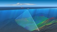
Nortek is supporting metocean survey and consulting company Partrac to provide floating wind farm developers with detailed and accurate data on metocean conditions at potential development sites. Using acoustic Doppler...
Teledyne Marine has been awarded the contract for the supply of two RESON HydroSweep DS Deep-Sea multibeam echosounder systems by the Indian Naval Hydrographic Department (INHD). The first of the...

Swathe Services, the UK-based hydrographic survey services company, has recently expanded its equipment rental pool capability with a suite of GeoAcoustics products. James Williams, managing director at Swathe Services, said:...

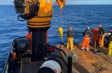
Global subsea services company Modus Subsea Services has been awarded a contract to perform survey services in connection with a new cable corridor requirement in Ofotfjorden, northern Norway. The campaign...
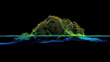
RIEGL tested the performance of its topobathymetric airborne laser scanning system in a transition zone context along the French Mediterranean coast. Initially planned as a UAV survey, tests were conducted...
EdgeTech, one of the leading companies in high-resolution sonar imaging systems and underwater technology, has recently introduced a new combined tri-frequency sidescan sonar and high-resolution sub-bottom profiling sonar system. The...
Scientists of the JPI Oceans project ‘MiningImpact’ are embarking on a six-week expedition to the Clarion-Clipperton Fracture Zone in the Pacific. Their goal is to carry out independent scientific monitoring...
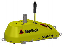
EdgeTech, a leading company in high-resolution sonar imaging systems and underwater technology, has recently introduced two new pole-mount sub-bottom profilers to the family of 3400 sub-bottom profiling systems. Building on...
This site uses cookies. By continuing to use this website, you agree to our Cookies Policy. Agree