David Millar
David Millar is Fugro’s government accounts director for the Americas, based in the Washington DC area. He oversees the development and execution of partnerships with national governments, the United Nations,...

David Millar is Fugro’s government accounts director for the Americas, based in the Washington DC area. He oversees the development and execution of partnerships with national governments, the United Nations,...

Combining AUV and ROV capabilities in a modular, hybrid unit improves functionality, while subsea docking technology expands the operational window of such a vehicle, allowing it to carry out multiple...
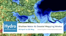
Hydro International proudly presents the Shallow Water & Coastal Mapping Weeks, which will immerse you in experiences, tools and advances in mapping shallow water topography and coastal environments. The generation of...
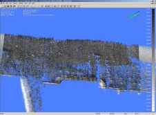
Laser scanning and bathymetric side-scan sonar represent the cutting edge of environmental survey technology. Over the last few years, we have tested the integration of these two methodologies, carrying out...
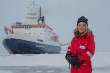
After eventful and busy months, the Arctic season of the ArcWatch-1 Polarstern expedition ended this weekend. The team of almost 100 crew and scientists measured sea ice thickness and properties,...
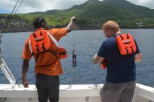
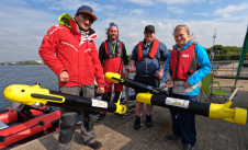
The UK Hydrographic Office (UKHO) has conducted a seabed mapping data survey in Montserrat to improve the safety of navigation around the island and to help understand, manage and protect its...

The Nippon Foundation-GEBCO Seabed 2030 Project is seeking support for its collaborative initiative to map the world’s oceans by 2030 and compile all bathymetric data into the freely available GEBCO...
The Nippon Foundation-GEBCO Seabed 2030 Project has entered into a strategic partnership with ecoSUB Robotics, a subsidiary of Planet Ocean, specialized in the design and construction of autonomous underwater vehicles...

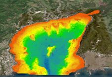
A researcher and crew at Middlebury College in Vermont are using bathymetric technologies to develop a map of the depths of Lake Champlain. Between 2012 and 2020, Professor Tom Manley and...
A deep understanding of seabed topography and coastal features is crucial for developing predictive models to address challenges such as coastal inundation and rising sea levels. Communities worldwide rely on...
This site uses cookies. By continuing to use this website, you agree to our Cookies Policy. Agree