Error in GNSS Augmented Heading Systems: Influence of Attitude
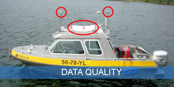
My earlier articles on the alignment of motion reference units (MRU) with the ships reference frame (SRF) did not cover the calibration of GNSS augmented heading systems. Although...
 In hydrography, there are many aspects influencing the quality of your data during acquisition, processing and managing the data. This theme gives an overview of articles reflecting on this subject.
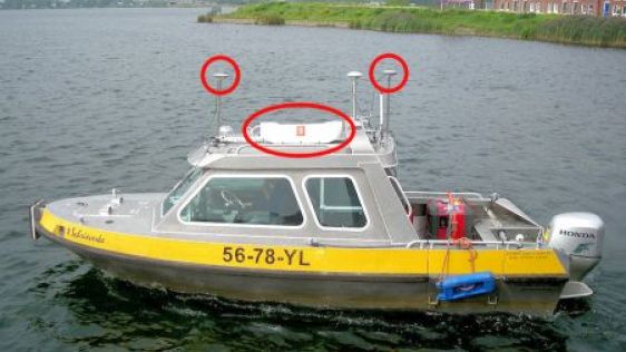
My earlier articles on the alignment of motion reference units (MRU) with the ships reference frame (SRF) did not cover the calibration of GNSS augmented heading systems. Although...
The Naval Oceanographic Office (NAVOCEANO) utilises a diverse suite of survey assets to collect high-resolution oceanographic and hydrographic data in shallow-water areas all over...
Every month we will focus on a specific theme, featuring a selection of articles which have previously been published in Hydro International magazine. to present a complete recap of the subject. If you don't want to miss these themed recaps, sign up for the newsletter (sign up here).
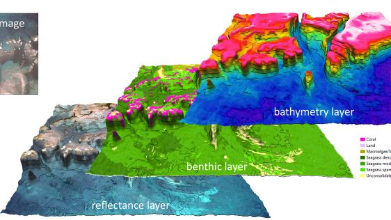
A recent article provides an overview of satellite-derived bathymetry methods and how data can be integrated into survey campaigns, and showcases three use cases. Bathymetric data...
Seaports, waterways and climate are inextricably linked. Weather anomalies change bottom contours and destroy aids to navigation, compromising safety. In the past decade, maritime...
For hydro- and topographic surveying companies it is common to gather data in the field and process it into formats for presentation. Nowadays, technology provides more and m...
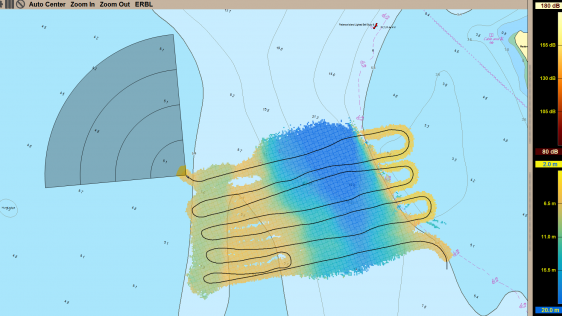
Hydrographic surveys in very shallow waters can have several applications such as nautical chart updating, performing environmental monitoring and characterisation, determination o...
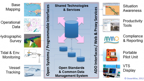
Ports require access to a wide range of data and information to function safely and efficiently. Some of that data is acquired from external stakeholders but most is generated inte...

The Port of London Authority (PLA) has had an extensive tide gauge network for many years. However, the existing system, installed in the 1990s was becoming increasingly unreliable...
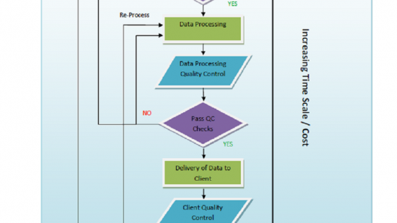
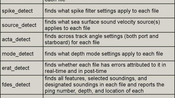
Quality control of survey data is an integral part of any hydrographic survey or inspection operation, but the focus is too often concentrated on the wrong sensors, the carrying ou...

Telepresence, in this context, refers to the suite of technologies and operational methodologies required to allow key mission personnel to be located onshore while conducting ship...

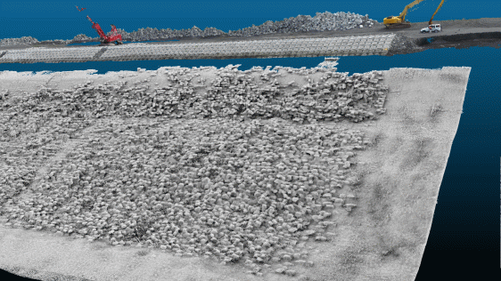
Synthetic Aperture Sonar (SAS) has been around for over a decade but its primary purpose has been in mine detection rather than hydrographic surveying. To use SAS effectively a sta...

There is definite appeal to the concept of crowdsourced bathymetric data. But from where I sit as a National Hydrographer and nautical chart producer, the issues around using crowd...
Follow Hydro International on Facebook, LinkedIn, Twitter or sign up for the newsletter! Don't miss the latest developments: join Hydro International!
 |  |  |  |
| 14.540 SUBSCRIBERS | 7.245 MEMBERS | 5.205 LIKES | 4.632 |
This site uses cookies. By continuing to use this website, you agree to our Cookies Policy. Agree