Hydrographic offices (HOs) today exist in a world of accelerating technological change that is influencing human behaviour and creating new needs for and ways of exploiting data to understand our worl...

“In all beginnings dwells a magic force …”. Hermann Hesse’s famous verse seems to be particularly relevant to the coming decade when it comes to marine activities. Three ambitious global proje...
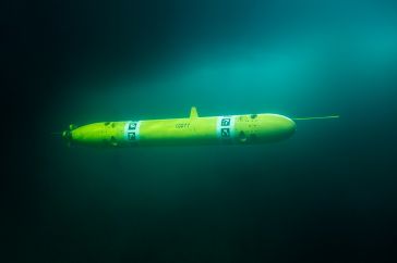
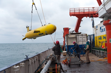
Autonomous underwater vehicles are becoming more and more common in the maritime industry, and technology is rapidly developing for different applications, such as inspection, maintenance and surveill...
Although the single beam echosounder is still in use, it has over the last 25 years gradually been replaced with new and less expensive multibeam echosounder (MBES) systems. And, although some sidesca...
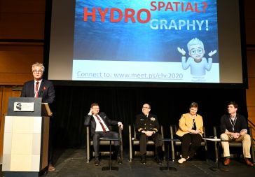
In the last decades, we have progressed from ‘graphic’ to ‘digital’ and now to ‘spatial’. During the opening plenary session of the Canadian Hydrographic Conference (CHC) 2020, the author ...
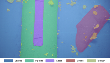
In 2019, Swire Seabed successfully used a novel AUV/USV solution to complete a commercial pipeline inspection campaign, surveying 175km of pipe. This involved the use of a HUGIN AUV paired with the SE...
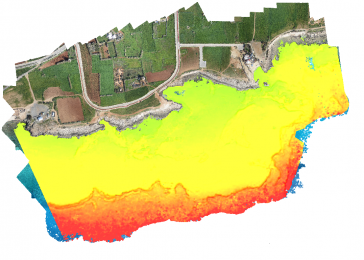
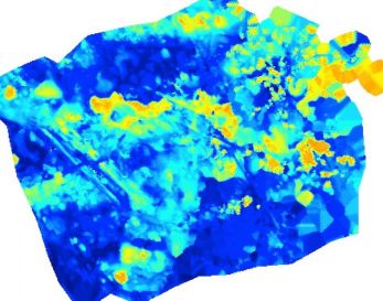
Accurate bathymetric mapping of shallow areas is essential for many offshore activities. Through Structure from Motion (SfM) and Multiview Stereo (MVS) techniques, images can provide a low-cost alter...
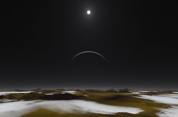
While there is still lots of ocean mapping work to do on Earth, oceans situated elsewhere in our solar system hold plenty of mysteries too, writes Wim van Wegen in this column. The oceans on our plane...
How can AUVs be reliably used to map the 3D structure of the underside of sea ice, especially now that the climate crisis makes it more important than ever to understand its complex structure? Sea ice...
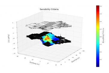
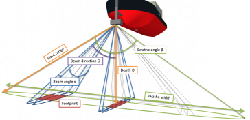
Currently, calibration of multibeam echosounders (MBES) for hydrographic surveys is based on the traditional ‘patch test’ method. This subjective method, although rigorous, has major drawbacks, su...
It is widely and wrongly assumed that the world’s coastal regions have been surveyed in detail by modern techniques and that the resulting nautical charts are an accurate reflection of the nature of...
Certification is the next step in your hydrographic and offshore surveying career, according to experienced hydrographic surveyor Bruce Calderbank. The Canadian Hydrographer Certification Scheme (CHCS...

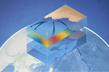
With millions of people around the world at risk from rising seas, it is essential to continue measuring the changing height of the sea surface to ensure that decision makers are equipped to take appr...
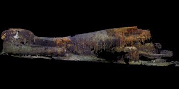
After 75 years, and using advanced imaging technology, ocean explorer Tim Taylor and his Lost 52 expedition team have officially discovered the final resting place of the 49 sailors of the US submari...
This site uses cookies. By continuing to use this website, you agree to our Cookies Policy. Agree