Hidden landscapes: the mapping of Ireland’s shelf geomorphology
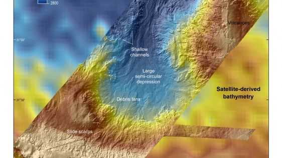
The Marine Geoscience Research Group at University College Cork, under the aegis of the Irish Marine Institute, has published the first high-resolution geomorphological map of most...

The Marine Geoscience Research Group at University College Cork, under the aegis of the Irish Marine Institute, has published the first high-resolution geomorphological map of most...
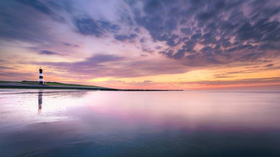
Given the Netherlands’ geographical location, it is unsurprising to find it has a long tradition of hydrography. The lowland, often below sea level, forms a delta where major...
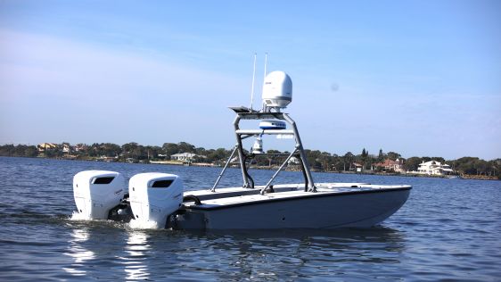
In an era of great power competition, unmanned maritime systems (UMSs) have begun to take centre stage and are now on an accelerated development path for reasons that are clear. Li...
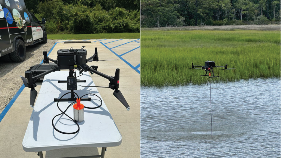
In the quest to unravel the mysteries beneath our planet’s water bodies, topobathymetric technologies emerge as a beacon of innovation. Among them, Lidar (light detection and...
For many years, the GeoSwath system from Kongsberg GeoAcoustics has provided an efficient simultaneous swath bathymetry and sidescan seabed mapping solution with accuracies that me...
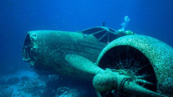
Although the number of aircraft lost at sea is not very high, over the past years a number of aircraft have suffered precisely that fate. With the recently renewed search for Malay...
The Israeli Navy Hydrographic Branch (INHB) is transforming itself into a 21st-century organization. Moving away from traditional methods of generating hydrographic products, INHB...
It is now well over ten years since Fugro Academy opened its doors within Fugro as a focal point for learning and development for the company’s 10,000-plus employees, who spe...

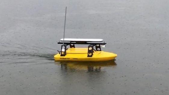
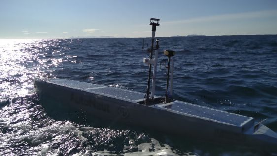
During September 2017, the world’s first autonomous hydrographic survey was performed. 'Autonomous' means not by remote control, but rather that the autonomous surface vehicl...
Optimizing the national hydrographic survey planning and monitoring scheme of the Netherlands Continental Shelf (NCS) towards an efficient and sustainable outcome requires a more c...
"Must have GWOs and be able to mobilise in the next 24 hours for 3-4 week cable project based in UK waters." 'How often do you see these words in an advertisement?' asks Emma Campb...
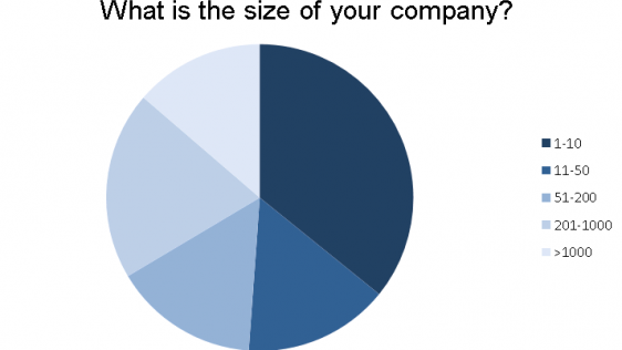
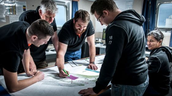
How is the hydrographic profession doing as a business? In the run-up to the start of 2018, 'Hydro International' decided to turn its sounder on and listen to the voices of th...

We are seeing the introduction and application of automated technologies everywhere that supplant the common and accepted ways of doing jobs, writes Paul Cooper. Indeed, the pages...

Production seafloor surveys for hydrography require careful planning, balancing many factors for operational efficiency. Requirements for meeting International Hydrographic Organiz...
Almost all (99%) international data is transmitted by around 265 subsea cable systems connecting the world. The total length of subsea cables exceeds 1.6 million kilometres, and th...

Current technologies can help ocean mappers and cartographers to fight repetitive, manual and error-prone routines the smart way. In a world where artificial intelligence is playin...

MapAction is a leading humanitarian mapping charity that works through skilled volunteers. Its purpose is to provide rapid, on-the-ground mapping to humanitarian aid agencies, in r...
GNSS has now been operational in the surveying industry, and especially in hydrography, for more than 25 years. Whereas the first receivers such as the Sercel NR103 (once the workh...
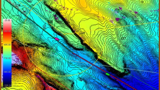
The disappearance of Malaysian Airlines flight MH370 on 8 March 2014 led to a deep ocean search effort of unprecedented scale and detail in the remote south-eastern Indian Ocean. B...
The Port of Rotterdam is a leading global port and by far the largest seaport in Europe. The port is situated in the Rhine delta and with its direct connection to Europe’s la...

Currents are traditionally measured with buoys and drifters, but such surveys are expensive and results are scarce. Almost all ships are equipped with an automatic identification s...

Over the past few years, the requirement for ROV support in the oil & gas sector has been hampered by the downturn in the sector. However, the continued investment in renewable...
The wave-propelled AutoNaut unmanned surface vessel (USV) completed a short trial off the south-west coast of England to monitor the water quality by a sewage outfall. AutoNaut dem...
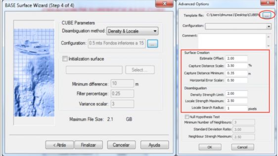
Interferometric sonars acquire millions of soundings in a hydrographic survey. The processing of this data by a hydrographer without a reliable statistical algorithm like CUBE (Com...

This site uses cookies. By continuing to use this website, you agree to our Cookies Policy. Agree