Hidden landscapes: the mapping of Ireland’s shelf geomorphology
The Marine Geoscience Research Group at University College Cork, under the aegis of the Irish Marine Institute, has published the first high-resolution geomorphological map of most...
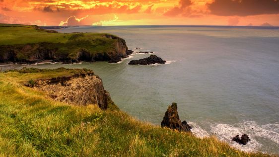
The Marine Geoscience Research Group at University College Cork, under the aegis of the Irish Marine Institute, has published the first high-resolution geomorphological map of most...
Given the Netherlands’ geographical location, it is unsurprising to find it has a long tradition of hydrography. The lowland, often below sea level, forms a delta where major...
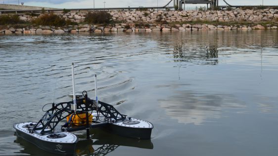
In an era of great power competition, unmanned maritime systems (UMSs) have begun to take centre stage and are now on an accelerated development path for reasons that are clear. Li...
In the quest to unravel the mysteries beneath our planet’s water bodies, topobathymetric technologies emerge as a beacon of innovation. Among them, Lidar (light detection and...
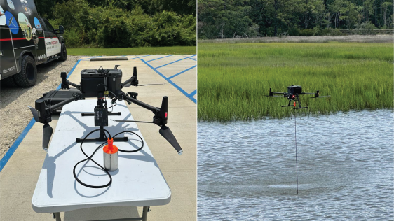
Hydrographic surveying in ultra-shallow, inland and enclosed waters can prove extremely challenging and often presents increased risks and obstacles to both personnel and equipment...
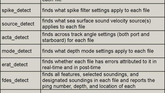
Starting in 2005, the French Naval Hydrographic and Oceanographic Office (Service hydrographique et océanographique de la marine [Shom]) and the French National Geographic I...
Coastal communities around the globe are seeking better ways to understand and manage regional ecosystems. They depend on the ocean to sustain economic opportunities, ensure food s...
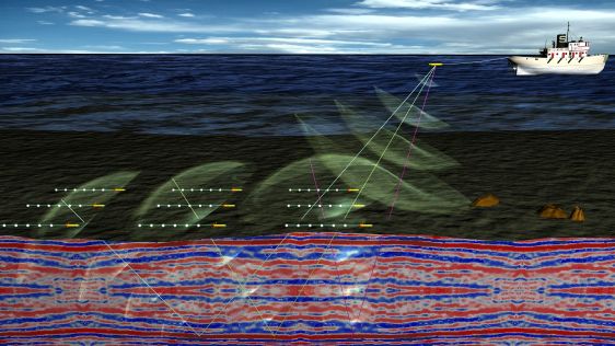
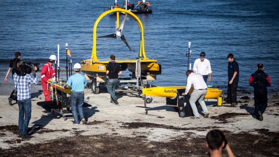
The ongoing WiMUST (Widely scalable Mobile Underwater Sonar Technology) project aims to design and test a system of cooperating autonomous underwater vehicles (AUVs) that would sim...
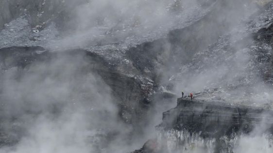
The 2,708m-high Poás Volcano is one of the most active volcanoes in Costa Rica, located 35km north-west of the capital San José. This stratovolcano contains a 300m-wi...
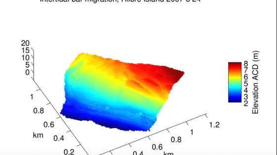
Shore-based marine radar techniques have recently proved to be an excellent tool for monitoring erosion and accretion in the dynamic nearshore area through repeated and automated l...
Seaports, waterways and climate are inextricably linked. Weather anomalies change bottom contours and destroy aids to navigation, compromising safety. In the past decade, maritime...
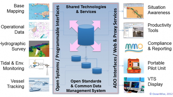
Ports require access to a wide range of data and information to function safely and efficiently. Some of that data is acquired from external stakeholders but most is generated inte...
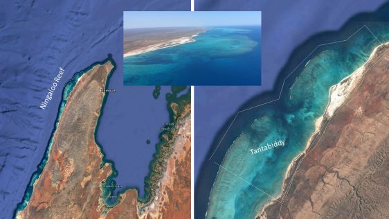
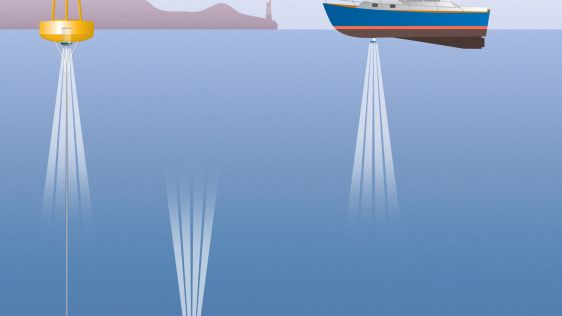
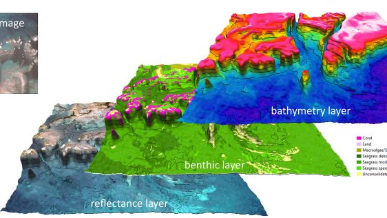
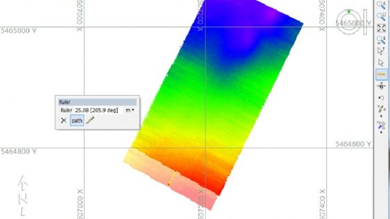
Airborne bathymetric Lidar is an ideal tool to study underwater features in the usually rather clear waters along the coast of Australia. Due to the remoteness of many of the conti...

The visualization of bathymetric data and associated uncertainty in electronic nautical charts (ENCs) is important when it comes to planning and monitoring a ship’s route saf...

In Portugal, emergency situations caused by sea waves are common, and usually have serious consequences for the economy and society. It is thus crucial to implement an early warnin...
Rather than a spinning propeller, the Acoustic Doppler Current Profiler (ADCP) – just like dolphins and bats – uses sound to explore its environment. Operating underwat...
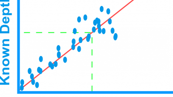
A recent article provides an overview of satellite-derived bathymetry methods and how data can be integrated into survey campaigns, and showcases three use cases. Bathymetric data...
During the past few years, autonomous underwater vehicles (AUVs) have established a greater presence in the hydrographic survey market and in the collection of oceanographic enviro...
Bathymetry is traditionally acquired using singlebeam or multibeam echosounders. This method produces accurate depth measurements along transects but is constrained by operating co...
Fugro has tested a multi-sensor approach to balance growing data needs with limited agency budgets. Coastal mapping programmes are quickly becoming a priority for government a...
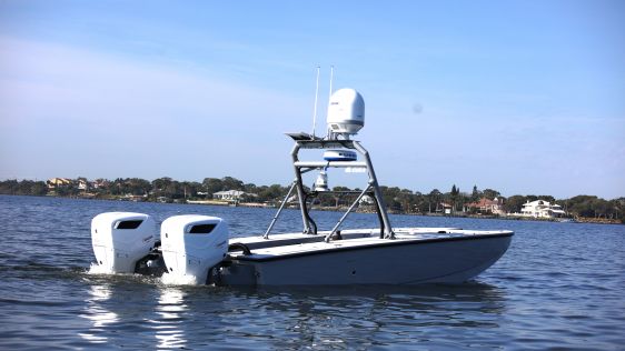
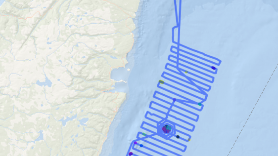
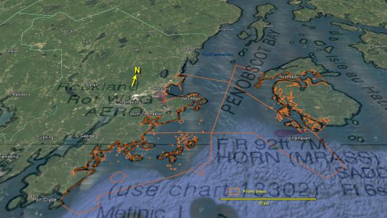
The Naval Oceanographic Office (NAVOCEANO) utilises a diverse suite of survey assets to collect high-resolution oceanographic and hydrographic data in shallow-water areas all over...
It’s often a cliché to say that everything offshore has changed since the introduction of GPS, but there have certainly been many changes since back then in the 1...

Discussing and comparing software has often been tricky in Hydro International as it is difficult to put the packages together and see clear differences. In this overview of h...
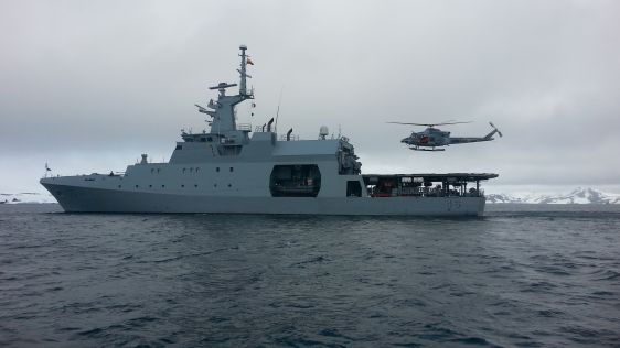
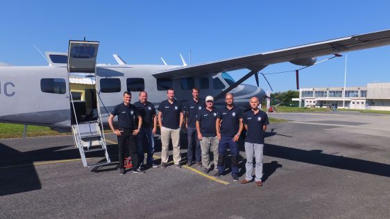
The first Colombian scientific expedition to Antarctica was a major challenge for the country and the Colombian Hydrographic Survey organisation because of the extreme conditions i...

This site uses cookies. By continuing to use this website, you agree to our Cookies Policy. Agree