Developments and Trends in Multibeam Echosounders
The multibeam echo sounders available on the market are constantly evolving as technology advances and as sonar producers seek new ways of refining and utilising the products. In t...
Every month we will focus on a specific theme, featuring a selection of articles which have previously been published in the Hydro International magazine. By including a mix of older and more recent articles, we will present a complete recap of the subject. Furthermore, we are bringing you a bi-weekly round-up of ‘Focus Stories’ related to the theme through our newsletter (sign up here). The theme for December 2017 is:
The multibeam echo sounders available on the market are constantly evolving as technology advances and as sonar producers seek new ways of refining and utilising the products. In t...
Almost all (99%) international data is transmitted by around 265 subsea cable systems connecting the world. The total length of subsea cables exceeds 1.6 million kilometres, and th...
This article is about the evolution of acoustic sounders imposed on Hydrographic Service’s new methodologies for the interpretation, handling and application of hydrographic...
![]()
Our partner geo-matching.com has a large database of multibeam echosounders. Compare up to 4 products and find the one that suits your project best!
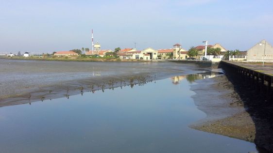
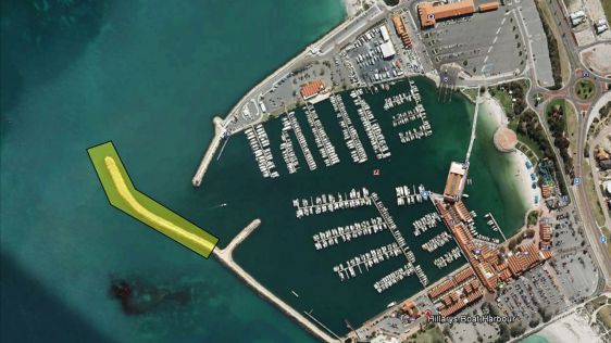
The North Sea Canal connects the Port of Amsterdam with the sea. The two breakwaters at the mouth of the harbour in IJmuiden, The Netherlands, are usually monitored on displacement...
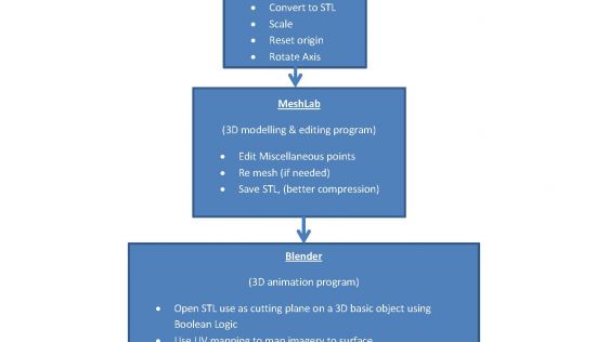
Great advancements have been made in three dimensional printing over the last few years and have made an impressionable impact across a variety of industries. 3D printings’ v...

Currently only ten to fifteen percent of the ocean floor has been mapped at resolutions of 100-metre pixel size or better and the vast majority of this mapped area is within territ...
Hydrographic surveys in very shallow waters can have several applications such as nautical chart updating, performing environmental monitoring and characterisation, determination o...
The evolution of multi-beam echo sounders (MBES) is leading to systems with enhanced capabilities in their traditional markets, but also provides features to allow the expansion of...
The search for resources and energy reserves for the future is continuously increasing in the polar region. More and more states are trying to stake their claims and to register th...
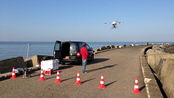
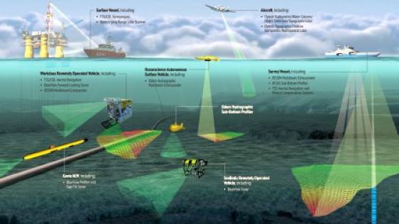
Advances in marine & terrestrial scanning survey techniques together with precise inertial navigation sensors, multi-sensor acquisition systems and cost-effective UAS photogram...
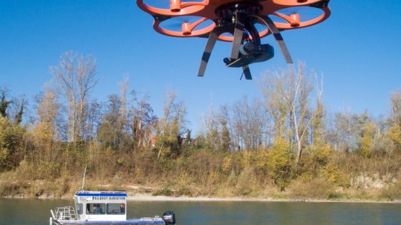
TerraSond, a hydrographic services company based in Palmer, Alaska (USA), used a C-Worker 5 (CW5) unmanned autonomous surface vessel (ASV) in conjunction with a 105’ (32m) re...

Two-thirds of our planet surface is covered by water and yet what lies underneath is a mystery to us. We know the ocean controls our weather and climate and is home to an estimated...
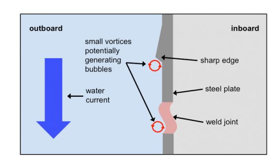
Within echo sounding circles it is well known that air bubbles may have a negative effect on echo sounding systems. This article briefly presents the German way of dealing with air...
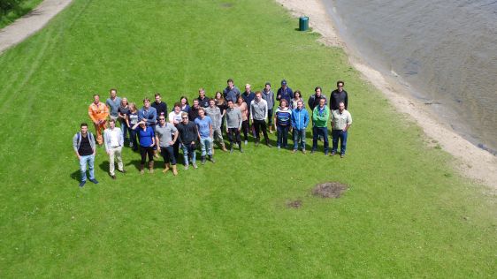
Twenty 3rd-year students of ocean technology from the Maritime Institute Willem Barentsz (MIWB, The Netherlands) participated in the 4th edition of the Lake Survey. Building on las...
The US Navy and the Naval Oceanographic Office (NAVOCEANO) are committed to realising the vision that Autonomous Underwater Vehicles (AUVs) are available, affordable, and can play...
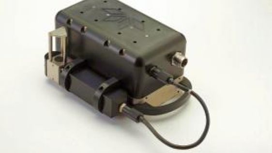
Teledyne Marine Acoustic Imaging Group is part of Teledyne Marine and is a provider of advanced multibeam echo sounder and sonar solutions servicing a variety of markets and applic...
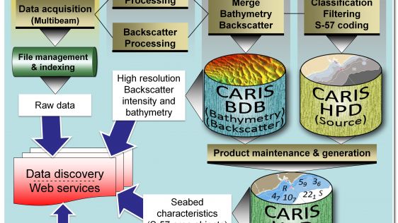
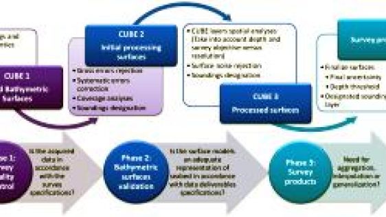
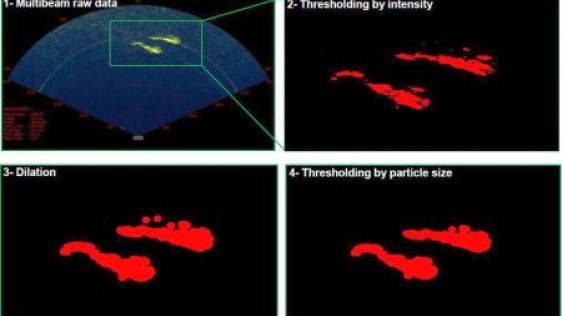
The Canadian Hydrographic Service (CHS) is willing to make better use of the backscatter intensity data collected with their multibeam sounding systems. All the backscatter data co...
Despite the last decade’s flurry of UNCLOS ECS mapping, the amount of the oceans surveyed remains around 12%. The continuing search for the MH370 wreckage emphasises our scan...
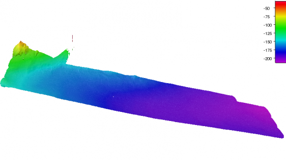
Knowing the volume of material present in a gravel quarry can make the difference between profit and loss. A gravel quarry in Hartheim am Rhein, southwest Germany, is partially cov...
The biennial event Shallow Survey was held in Plymouth, UK, from 14-18 September 2015. The Roland Levinsky building of the university hosted the conference, welcoming over 300 dele...
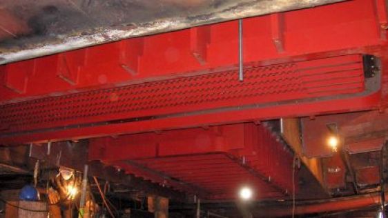
The Port of Rotterdam is a leading global port and by far the largest seaport in Europe. The port is situated in the Rhine delta and with its direct connection to Europe’s la...
Recent hydrographic advances are revolutionising the way the marine environment can be accessed, scanned and quantified. With the emergence of sonar technology and, more recently,...
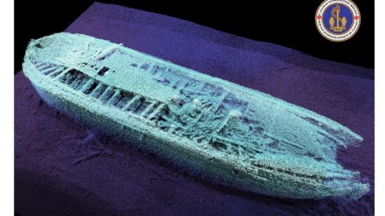
“We know where the target is not located” is the only guaranteed result of any search expedition. This statement does not make for exciting headlines, however, the valu...
Follow Hydro International on Facebook, LinkedIn, Twitter or sign up for the newsletter! Don't miss the latest developments: join Hydro International!
 |  |  |  |
| 14.540 SUBSCRIBERS | 7.245 MEMBERS | 5.205 LIKES | 4.632 |
At Hydro International, we often receive permission requests to use our articles for republishing purposes. Get permission to reuse our content quickly and easily with PLS Permissions Request. Simply search for Hydro International and fill in the article you are looking for.
This site uses cookies. By continuing to use this website, you agree to our Cookies Policy. Agree
